Soil moisture
Soil moisture
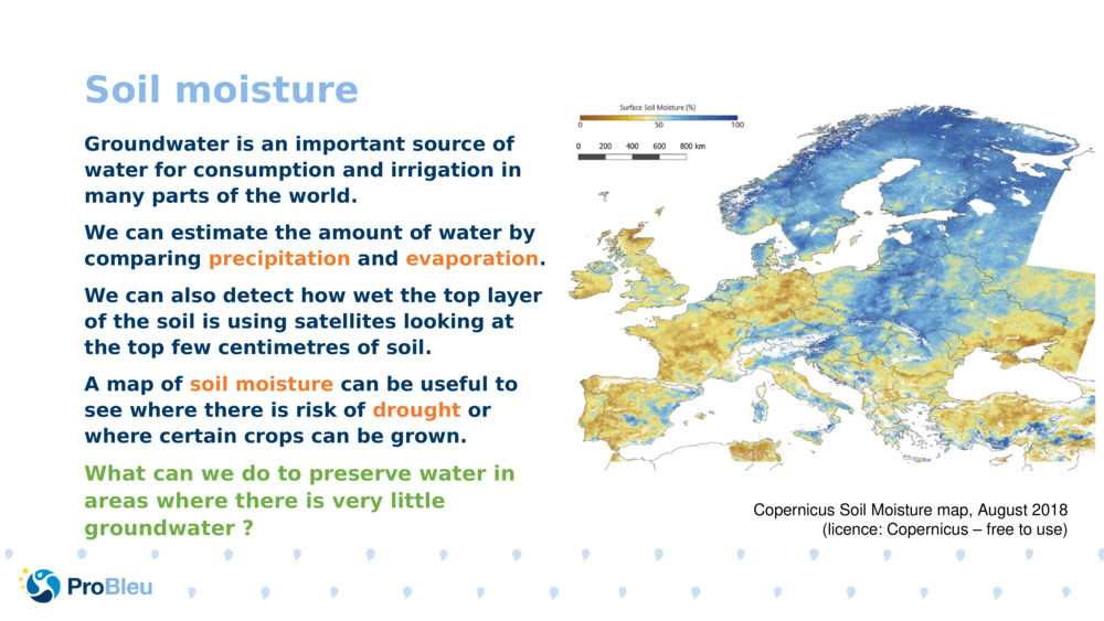
Soil moisture Groundwater is an important source of water for consumption and irrigation in many parts of the world. We can estimate the amount of water by comparing precipitation and evaporation . We can also detect how wet the top layer of the soil is using satellites looking at the top few centimetres of soil. A map of soil moisture can be useful to see where there is risk of drought or where certain crops can be grown. What can we do to preserve water in areas where there is very little groundwater ? Copernicus Soil Moisture map, August 2018 (licence: Copernicus – free to use)

Original Slide Deck: Freshwater Resources
Topics: Freshwater. Weather. Nutrient Pollution.
Suitable Ages: 10. 11. 12. 13.
Keywords: Drought. Ecosystems. Eutrophication. Floods. Food Web. Freshwater. Freshwater Monitoring. Harmful Algal Blooms (Hab). Nutrients. Pollution. Satellite. Soil Moisture. Water Cycle. Water Quality. Water Use.
Uploaded By: pml-admin
Number of bundles using this content: 2
Licensed under CC BY 4.0
This content has been used in the following resource bundles:
Freshwater Resources
An introduction to the water cycle, freshwater resources, and threats ...
View Bundle[COPY]Freshwater Resources
An introduction to the water cycle, freshwater resources, and threats ...
View Bundle